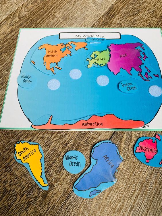
Colored construction paper (for continents and background)
Scissors
Glue sticks
Blue construction paper (for the water)
World map template or outline (optional for guidance)
Preparation:
Cut out various colored construction paper into shapes representing different continents (or provide templates for students to trace and cut out).
Prepare blue construction paper to be used as the background representing the world’s oceans.
Introduction:
Discuss the names and locations of the continents and show a simple world map for reference.
Explain how students will use construction paper to create their own world map by cutting out the continents and pasting them onto the blue background.
Activity:
Distribute the construction paper, scissors, glue sticks, and blue background paper to each student.
Instruct students to cut out the continent shapes from the colored construction paper.
Have students paste the cut-out continents onto the blue paper to create a world map. Encourage them to arrange the continents in the correct positions or according to their understanding.
Optionally, students can label each continent on their map with their names.
Conclusion:
Review the completed world maps with the class, discussing the placement of each continent and any other observations students may have.
Reinforce the concept of continents and their locations in relation to one another.
Extension:
Introduce additional elements such as labeling the oceans or adding major landmarks.
Discuss how maps can be used to represent different types of information and explore other map-related activities.