Plataforma de Educação Humanizada

Torne-se Membro

Creating a 3D Model of Earth’s Layers

Disciplina: Science
Ano escolar: 2nd | 3rd | 4th
Tipo de Recurso:
Tags:

Materials Required:

Blank paper (preferably cardstock for sturdiness)
Rulers and protractors for precise measurements
Pencils and erasers for drawing and marking
Coloring pencils or markers to differentiate layers
Scissors for cutting out the model
Glue for assembling the model
Compass (optional for drawing accurate circles)
Picture of the Earth’s cross-section (provided by the teacher)
Steps Involved:

Introduce Earth’s Layers: Begin by discussing the different layers of Earth: Inner Core, Outer Core, Mantle, and Crust. Explain their respective thicknesses and characteristics.
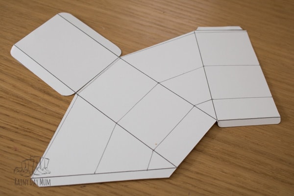
Draw the Triangle: Students will use the provided picture as a sample to draw an equilateral triangle on their paper. This triangle will serve as the base for their 3D model, representing a cross-section of the Earth.
Measure the Radius: Have students measure the distance from the tip of the triangle to the base. This represents the radius of the Earth in their model.
Calculate the Scale: Students will calculate the scale for their model by dividing the measured distance by Earth’s actual radius (6,384 km). For example, if the length is 105mm, they will divide 105 by 6,384 to get the scale factor (e.g., 0.016mm per 1 km).
Determine Layer Thickness: Using the calculated scale, students will determine the thickness of each Earth layer on their model:
Inner Core: 1,255 km × scale factor (e.g., 0.016) = 21 mm
Outer Core: 2,221 km × scale factor = 37 mm
Mantle: 2,900 km × scale factor = 48 mm
Crust: 8 km × scale factor = 1 mm
Draw the Layers: Starting from the point of the triangle, students will measure and mark the distance for the Inner Core on each side of the triangle. They will connect these points with a straight line to form the boundary of the Inner Core.
Repeat for Other Layers: Repeat the measurement and drawing process for the Outer Core, Mantle, and Crust, marking each layer accurately based on the calculated distances.
Add Details and Color: After the layers are drawn, students will color each section to represent the different parts of the Earth:
Red for the Inner Core
Orange for the Outer Core
Yellow for the Mantle
Brown for the Crust
Blue and green for the ocean and land at the end of the pie-shaped section.
Cut Out the Model: Carefully cut out the triangle and fold along the lines to assemble the 3D model of the Earth’s layers.
Review and Discussion: Finally, students will review their models, comparing them with their peers, and discuss the accuracy and significance of each Earth’s layer.